Rainfall
Monthly Rainfall Outlook: March 2018
Issued: 28 Feb 2018
The NCEP CFSv2 model indicates that below normal rainfall is expected in the region south of the equator, i.e. most parts over Indonesia (Figure 1). However, it is notable that the skill of the model against Aphrodite and ERA-Interim over this part of Southeast Asia for March is low (Figure 2 and 3). Nevertheless this forecast for drier conditions in the south is in good agreement with ECMWF’s and JMA’s models, but not UK Met Office’s.
For the north-eastern part of Maritime Continent (near Philippines), NCEP’s model is predicting that near-average conditions are more likely, with only a hint of the possibility of above-average conditions. This however differs markedly with the other models (ECMWF, JMA, and UK Met Office) which gave stronger indications for above-average conditions. In general, model skill in March for this part of the region is good due the influence of ENSO.
For the rest of ASEAN region, the model skill is either low, or there is no dominant outcome from the NCEP CFSv2 model or other models (ECWMF, UK Met Office and JMA).

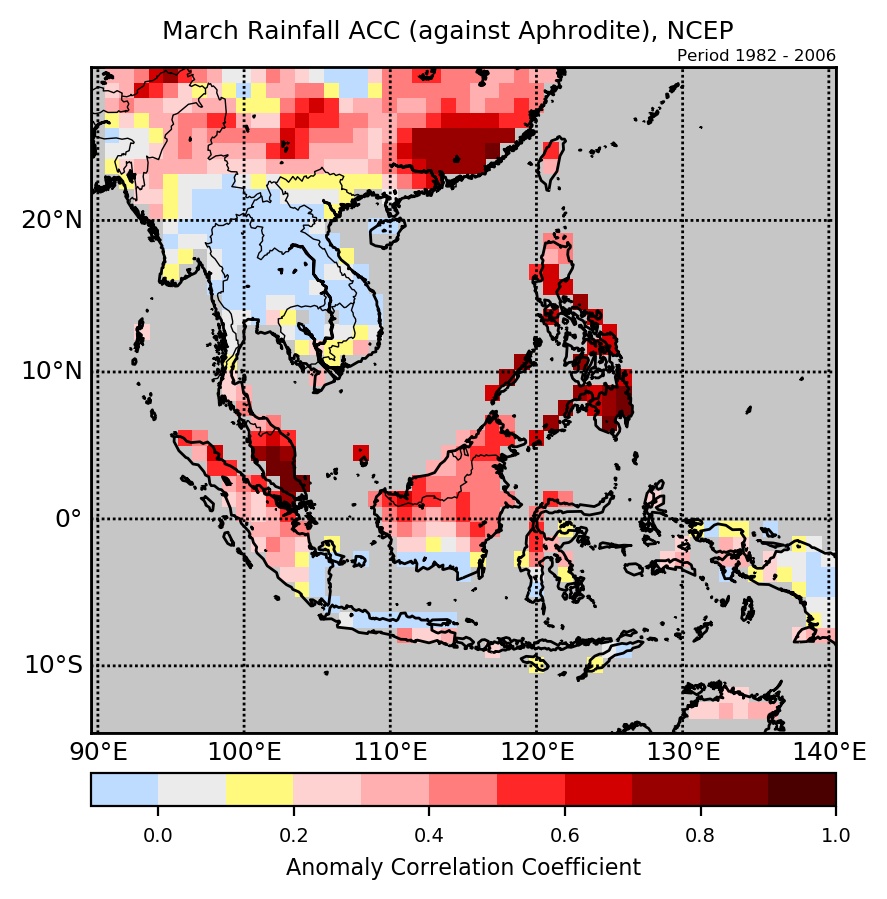
Figure 2: Anomaly Correlation Coefficient (ACC) of NCEP’s rainfall forecasts against APHRODITE.
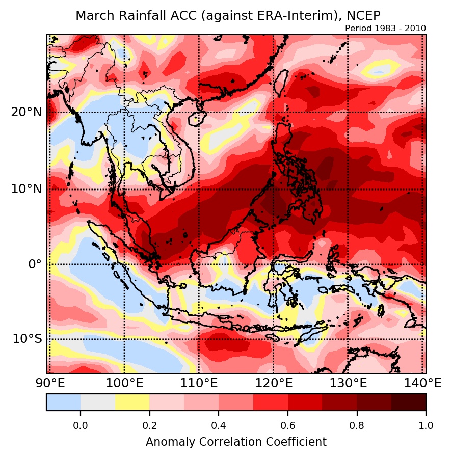
Figure 3: Anomaly Correlation Coefficient (ACC) of NCEP’s rainfall forecasts against ERA-Interim.