Rainfall
Seasonal Rainfall Outlook: November 2018 - January 2019 (NDJ)
Issued: 31 Oct 2018
For NDJ 2018/2019, below-normal or near-normal rainfall is favoured over much of the Maritime Continent. There is some agreement among the models of an increased chance of above-normal rainfall over the western equatorial region.
For NDJ 2018/2019, all three models – NCEP CFSv2, ECMWF, and UK Met Office (Figures 1-3) predict below-normal over the Philippines and below- to near-normal rainfall in the region surrounding the Java Sea and eastern Indonesia. All three models have generally good skill over these regions.
The models predict to various degrees an increased probability of above-normal rainfall over the western equatorial region (parts of northern Sumatra, Peninsular Malaysia and Borneo). However, the models do not predict an increased chance of way above normal rainfall (highest 20%), and model skill for this region is only low to moderate.
For the rest of the northern ASEAN region, there is little agreement between the NCEP CFSv2, ECMWF and UK Met Office models, with the skill generally low for this region during NDJ.

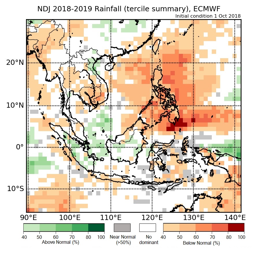
Figure 2: Rainfall tercile summary predictions of ECMWF model for NDJ 2018-2019 (contains modified Copernicus C3S information).
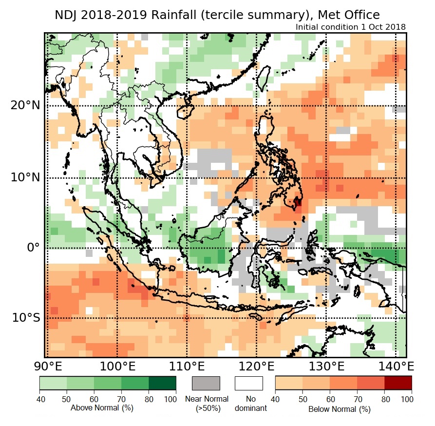
Figure 3: Rainfall tercile summary predictions of UK Met Office model for NDJ 2018-2019 (contains modified Copernicus C3S information).