Rainfall
Monthly Rainfall Outlook: September 2018
Issued: 31 Aug 2018
For September 2018, below-normal to near-normal rainfall is favoured over equatorial parts of the region, as well as northwards of 10˚N.
For September’s rainfall, all three models – NCEP CFSv2, ECMWF, and UK Met Office (Figures 1-3) – predict below-normal conditions over parts of the equatorial region (around southern Sumatra, Borneo, Sulawesi, and Papua), as well as over the coastal regions of northern Southeast Asia (north of 10˚N). The spatial extent and magnitude of the likelihood for below-normal conditions differ across the different models. In particular, for NCEP CFSv2, the likelihood for below-normal rainfall is higher than ECMWF or the UK Met Office. Furthermore, only NCEP CFSv2 favours above-normal conditions along the 10˚N latitude stretch, where the other two models predict below-normal or no dominant tercile.
The models’ skill for rainfall prediction are very good over south of the equator and moderate along the 10˚N stretch.

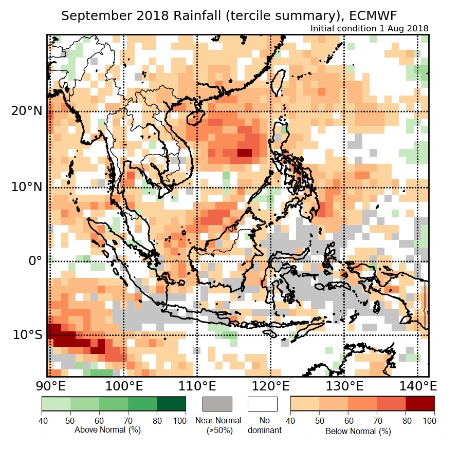
Figure 2: Rainfall tercile summary predictions of ECMWF model for September 2018 (contains modified Copernicus C3S information).
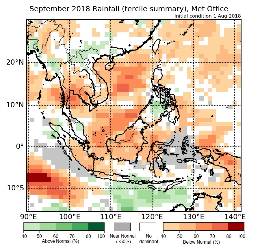
Figure 3: Rainfall tercile summary predictions of UK Met Office model for September 2018 (contains modified Copernicus C3S information).