Rainfall
Monthly Rainfall Outlook: August 2018
Issued: 30 Jul 2018
For August 2018, above-average rainfall is most likely in the north, with below-average rainfall most likely over central and southern Southeast Asia.
Based on the NCEP CFSv2 (Figure 1), ECMWF (Figure 2), and UK Met Office (Figure 3) models, all show pockets of above-average rainfall for the northern ASEAN region in August, mainly in coastal regions and Lao PDR. Based on the tercile plots, the NCEP CFSv2 model has highest probability of above normal rainfall followed by the ECMWF model. The UK Met Office model displays both a lower probability of above normal rainfall, as well as limiting the extent to coastal Myanmar, eastern Philippines and northern Vietnam. The model skill (Figure 4 and Figure 5) is low to moderate over the northern ASEAN region for this month.
Below-average rainfall is expected in the equatorial ASEAN region, including parts of Borneo and the Indonesian regions of Sulawesi, and Papua. From the tercile plots, the model with the highest probability of below normal rainfall for this region is the NCEP CFSv2 model, followed by the ECMWF and then UK Met Office models. All three models have good skill for the equatorial region.
For the rest of ASEAN region, the model skill is either low, or there is no dominant tercile from the NCEP CFSv2, ECWMF, and UK Met Office models.

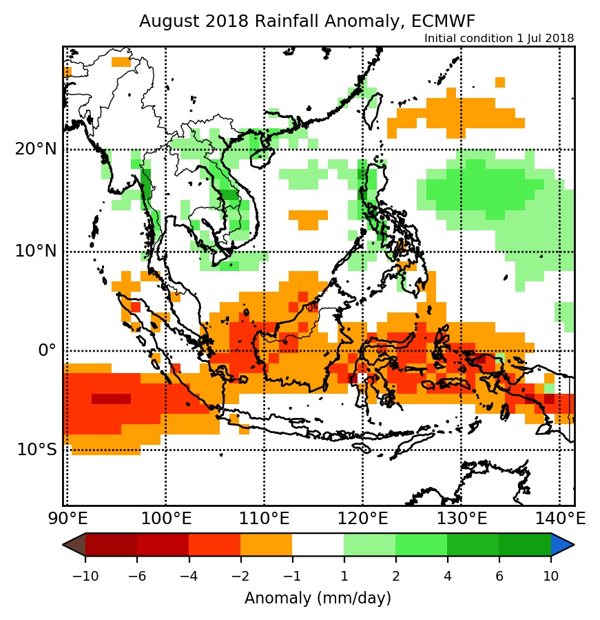
Figure 2: Rainfall anomaly of ECMWF model for August 2018 (contains modified Copernicus C3S information).
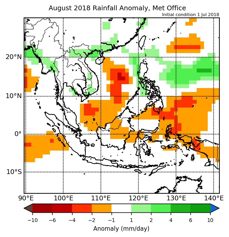
Figure 3: Rainfall anomaly of Met Office model for August 2018 (contains modified Copernicus C3S information).