Rainfall
Monthly Rainfall Outlook: June 2018
Issued: 30 May 2018
Based on the NCEP CFSv2 model for June 2018 (Figure 1), a band of above-average rainfall is predicted over parts of the Southeast Asia region centred around 10˚N (i.e. around Philippines Sea, Bay of Bengal and parts of South China Sea). This region has moderate to good skill against ERA-Interim (Figure 3) but limited skill against APHRODITE (Figure 2). Other models consulted (ECMWF, JMA, and UK Met Office) show agreement with this prediction over the Philippines.
NCEP CFSv2 predicts near-normal to below-average rainfall conditions around the equator and southwards (Figure 1). Its skill over this region is good for both APHRODITE and ERA-Interim (Figure 2 and Figure 3). Other models surveyed (ECMWF and JMA) predict similar conditions, but with spatial variations. UK MetOffice model predicts predominantly near-average conditions for this part of the region.

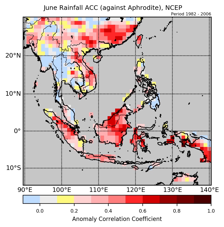
Figure 2: Anomaly Correlation Coefficient (ACC) of NCEP’s rainfall forecasts against APHRODITE.
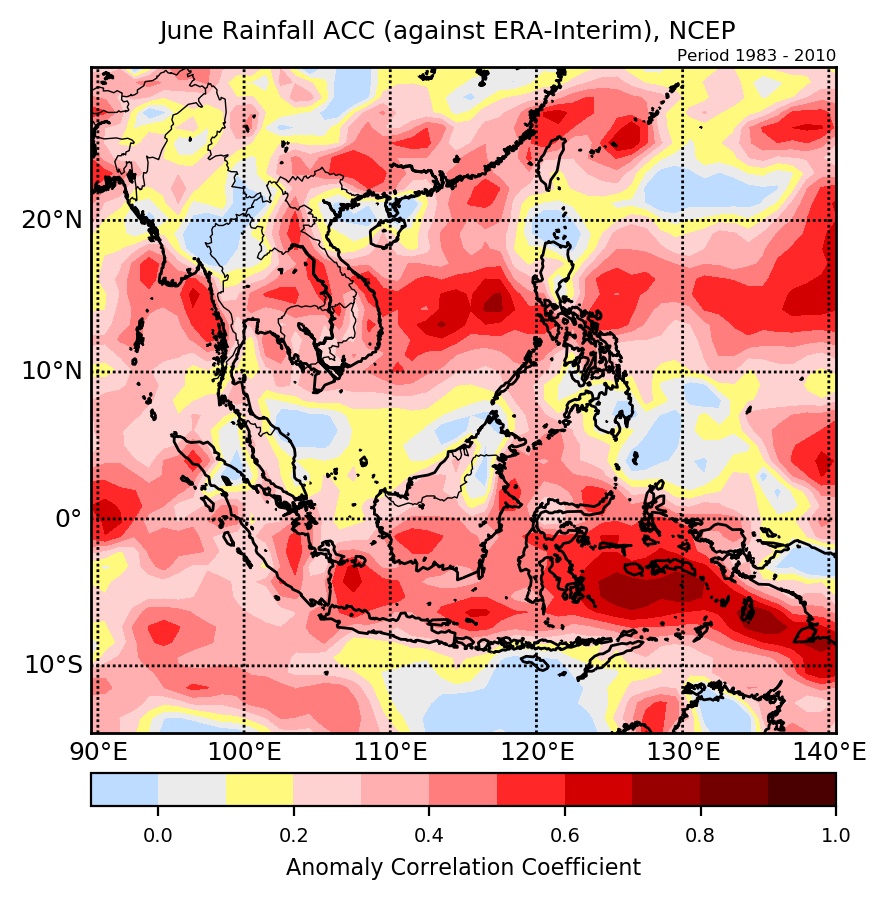
Figure 3: Anomaly Correlation Coefficient (ACC) of NCEP’s rainfall forecasts against ERA-Interim.